
When we crossed into California at the end of August, although we enjoyed our travels in Oregon, we were ready to leave the sad and unfortunate forest fire smoke behind. We found that the Golden State isn’t always all sun shine – sometimes it was enchantingly foggy – but it was always beautiful and it has such a vast variety of terrain and vegetation. It is so large and there was so much to see that I realize I have created one huge blog post here when I probably should have broken it into sections! At least it gives the feeling of traveling from top to bottom on the west side of the state!
The first day we were there, we went straight to Jedediah Smith Redwood State Park just outside of Crescent City. It is part of a string of redwood parks that are managed by the state and the National Park Service. We drove in the entrance and quickly realized that the road wasn’t going to be able to accommodate our 44 foot motor home. We were able to turn around and we found a place to park on the wide shoulder of Highway 199 outside the entrance.

We took the jeep back into the park and drove to the Stout Memorial Grove Trail
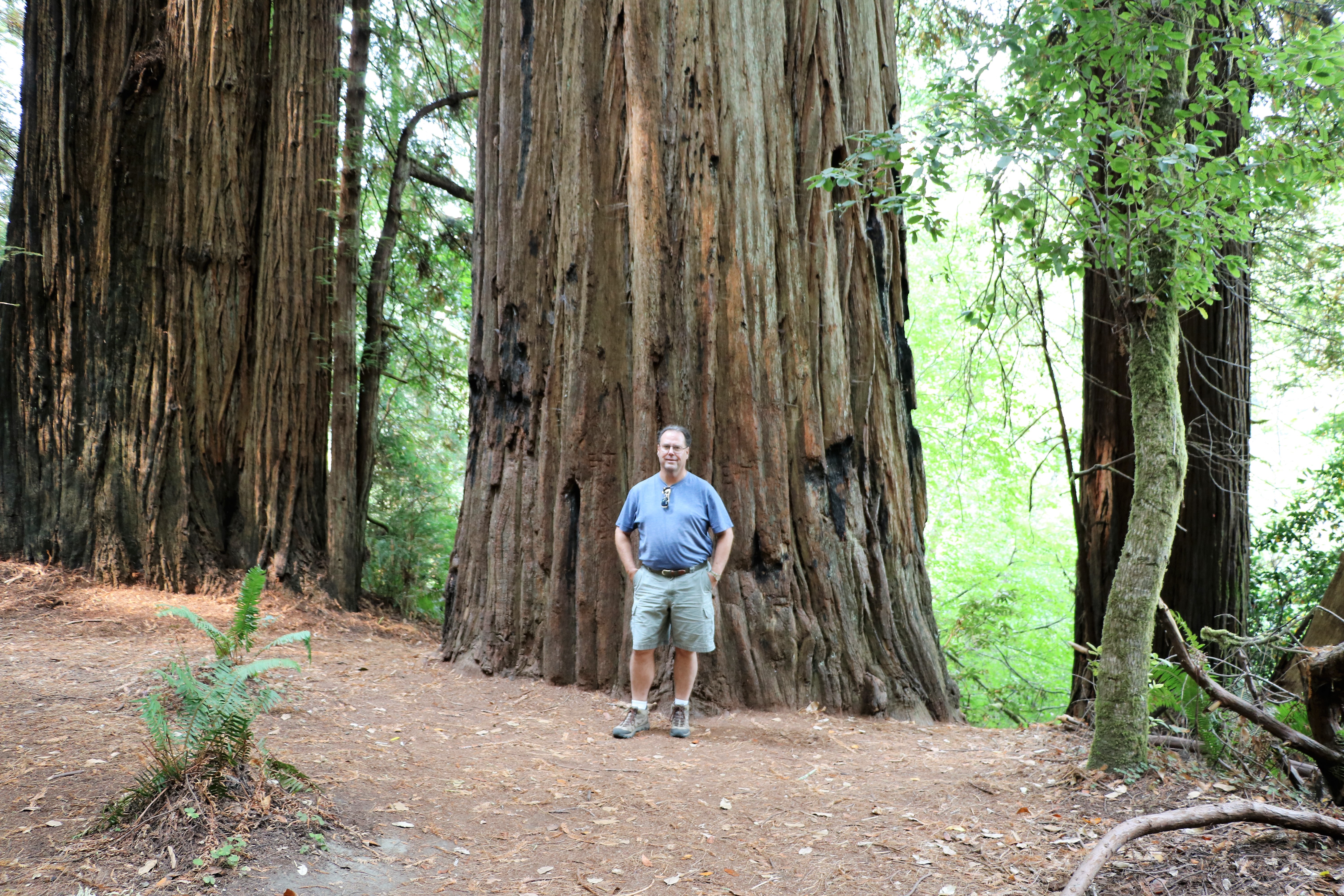
It was a nice, easy stroll and we saw some of the amazing huge redwood trees of northern California.
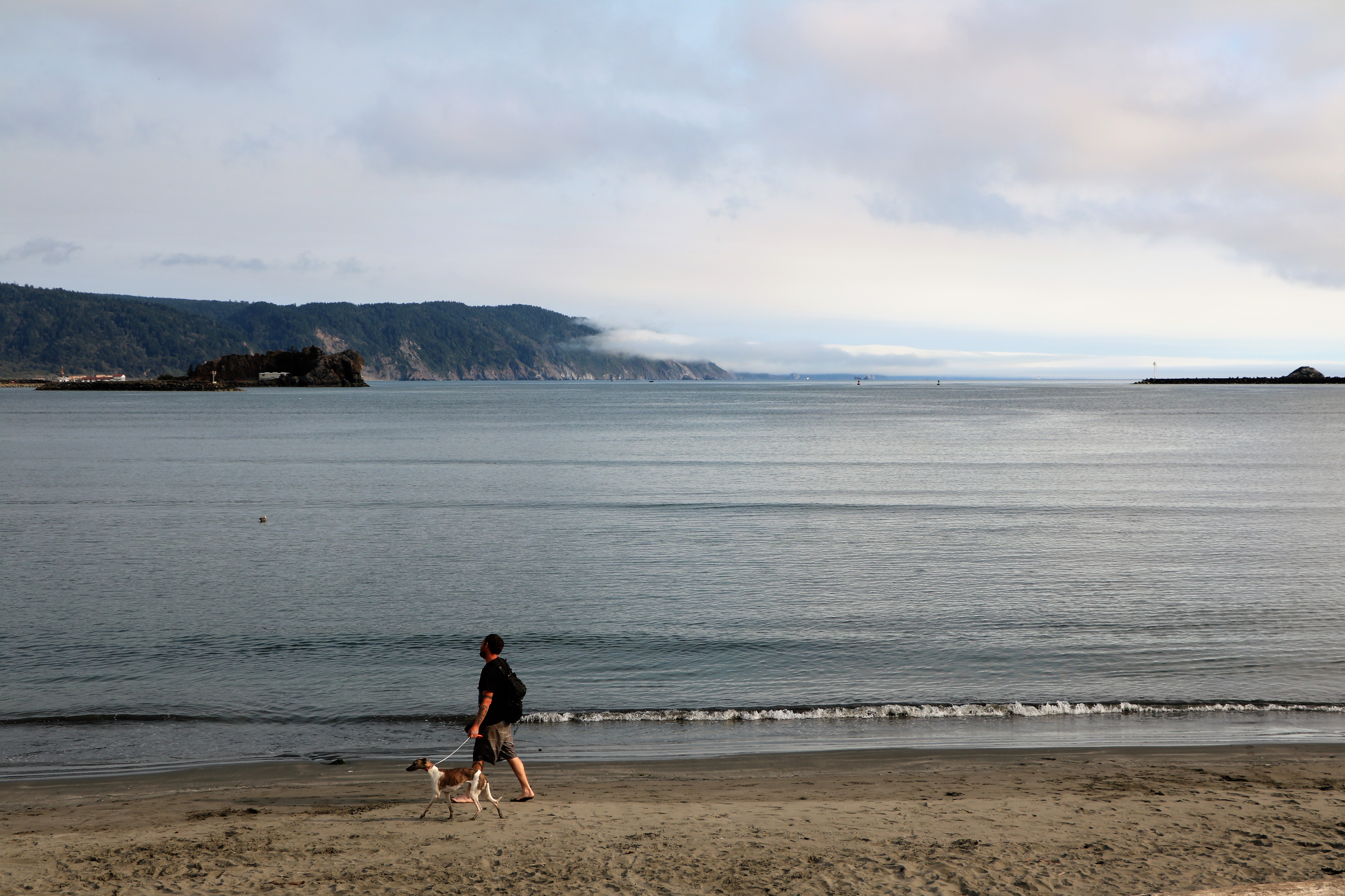
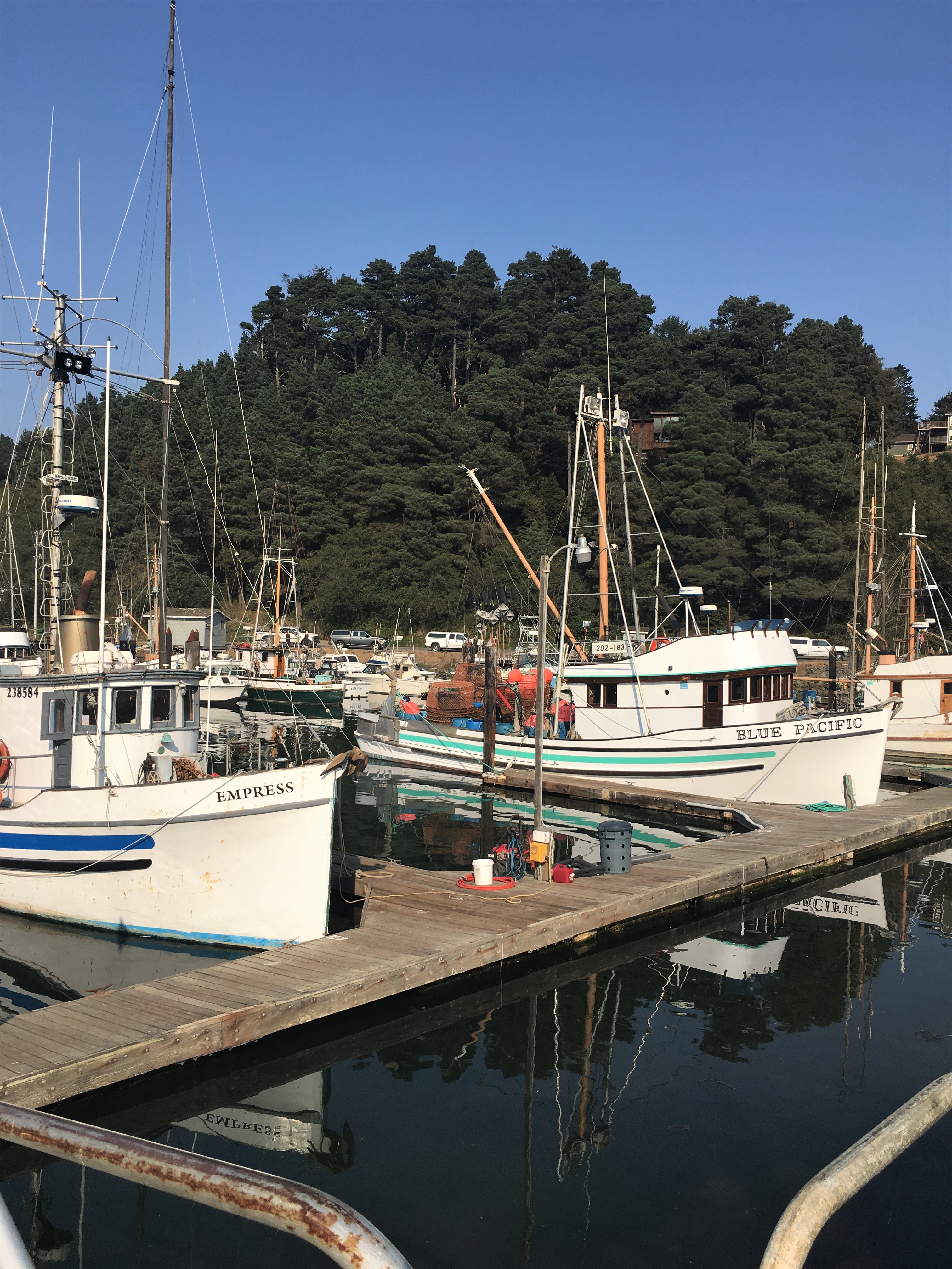
We parked the RV at the Crescent City Walmart (large parking area with lots of homeless people living out of their cars) and hopped in the jeep and went off to explore. The town of Crescent City has a nice beach and harbor.

Battery Point Lighthouse is registered as a California Historical Landmark.

We got on Highway 101, The Redwood Highway Scenic Byway, and drove a bit along the coast.

We exited Highway 101 at Klamath Beach Road and found what was left of a bridge that was built in 1926, but was destroyed by a flood in 1964. The Douglas Memorial Bridge once had a pair of California bears at each end and the two at the west end of the bridge are still there. The bridge was rebuilt on higher ground.
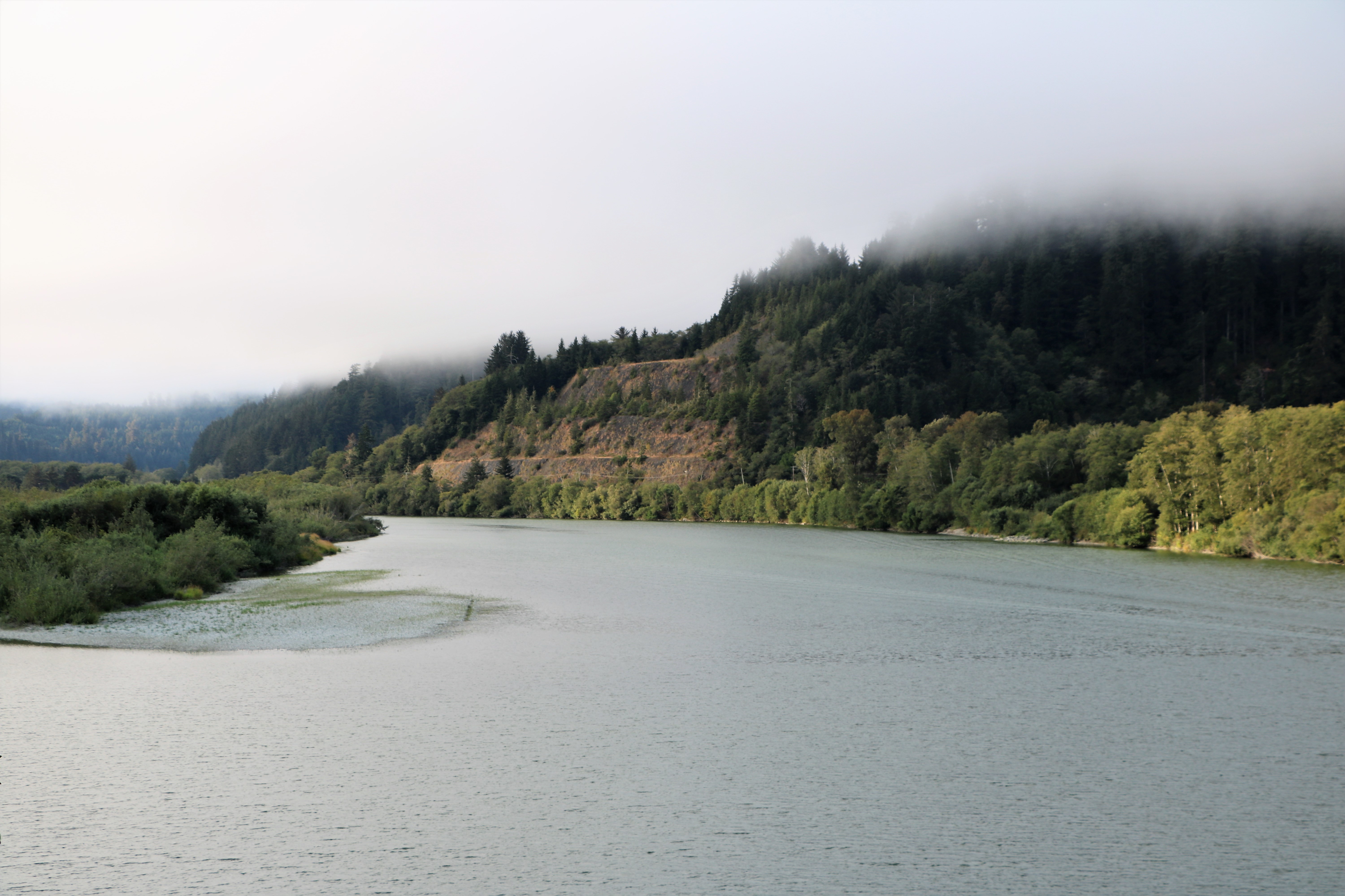
What’s left of the bridge juts out just enough to give a great view of the Klamath river.
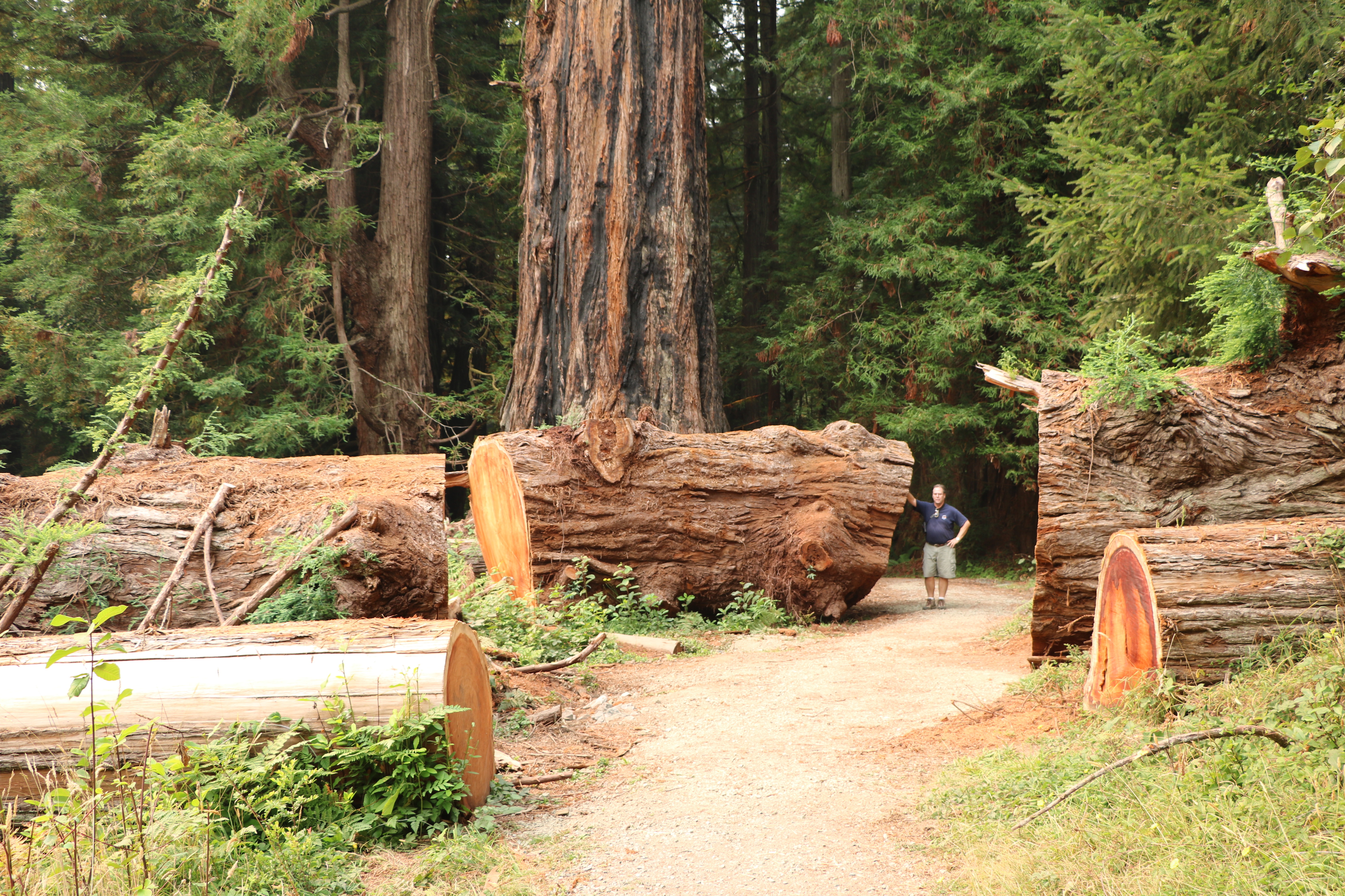
The next day we drove down Newton B Drury Scenic Parkway and explored just a bit of Prairie Creek Redwoods State Park.

Along the scenic drive there is a stop to see Big Tree. It’s about 1,500 years old, 286 feet tall, and has a circumference of 74 and a half feet. Since these giant redwoods get a lot of moisture from the air, the foggy northern California climate is just perfect to encourage sustained growth. Plus their bark, besides containing a chemical that resists bugs, is so thick that trees are able to survive forest fires.
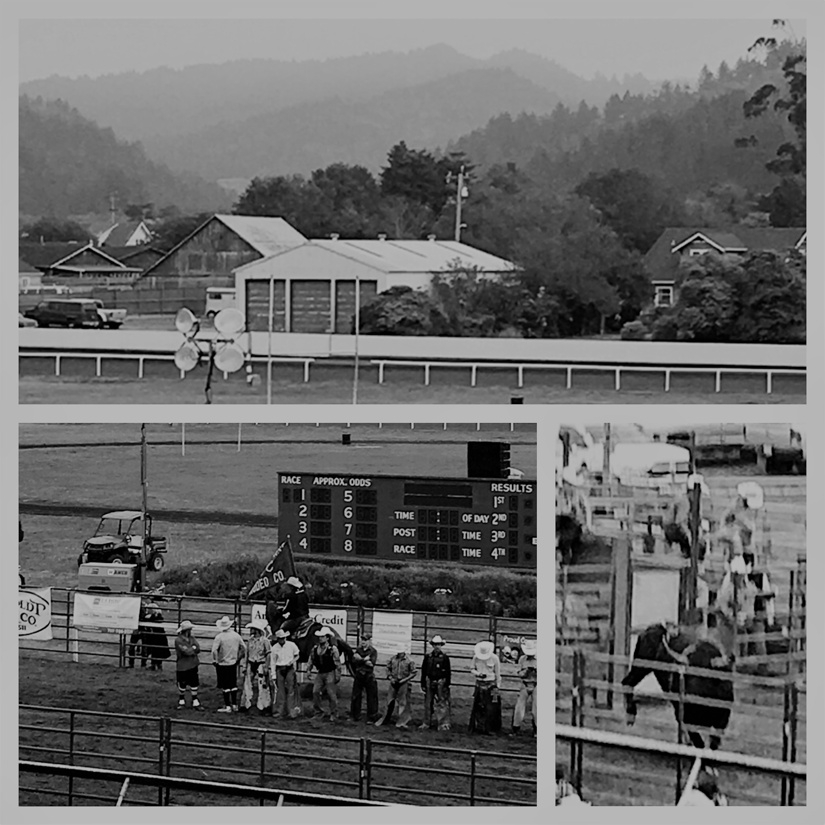
We spent the night in the charming town of Ferndale at the Humboldt County Fairgrounds RV parking area. The fair was going on and we went to the rodeo. It felt like a throwback in time. Apparently the Humboldt County Fair has had rodeo events since 1897 and the rodeo culture has deep California roots.
We slowed down over Labor Day Weekend and stayed in the RV Park at Dolphin Isle Marina in Fort Bragg for a few days. A road that snakes around the docked boats leads to place where the RVs are parked. It was slightly confusing at first and very narrow, but we figured it out. The sites were adequate; it was basically a somewhat grassy space with people who seemed to park there for extended periods.

While we were staying in Fort Bragg we took a day trip to lovely Mendocino.

Besides the Victorian architecture, cute shops, art galleries and cafes, Mendocino is known for its many water towers.

Literally just across the street from the restaurant and shopping area is Mendocino Headlands State Park. The views are pretty and it’s nice to either walk or car ride on Hesser Drive which follows the shore line.

On another day, we spent the afternoon at MacKerricher State Park. We were hoping to see some whales or seals, but I think it might have been the wrong time of year for them to swim by. The park has a famous glass beach where people search for bits of bottles that have been polished smooth by the waves and rocks. The shiny glass is made into jewelry and the like, although now people are not suppose to remove the sparkly pieces from the area.

We left Fort Bragg to spend a week at the Sonoma County Fairgrounds RV Park in Santa Rosa. It was a great location to take day trips north to wine country and also south to San Francisco.
The Santa Rosa house in the photo above is the mansion of which the exterior was used in filming the Disney classic Pollyanna. The town has a historic district called Railroad Square which has cute shops and restaurants.

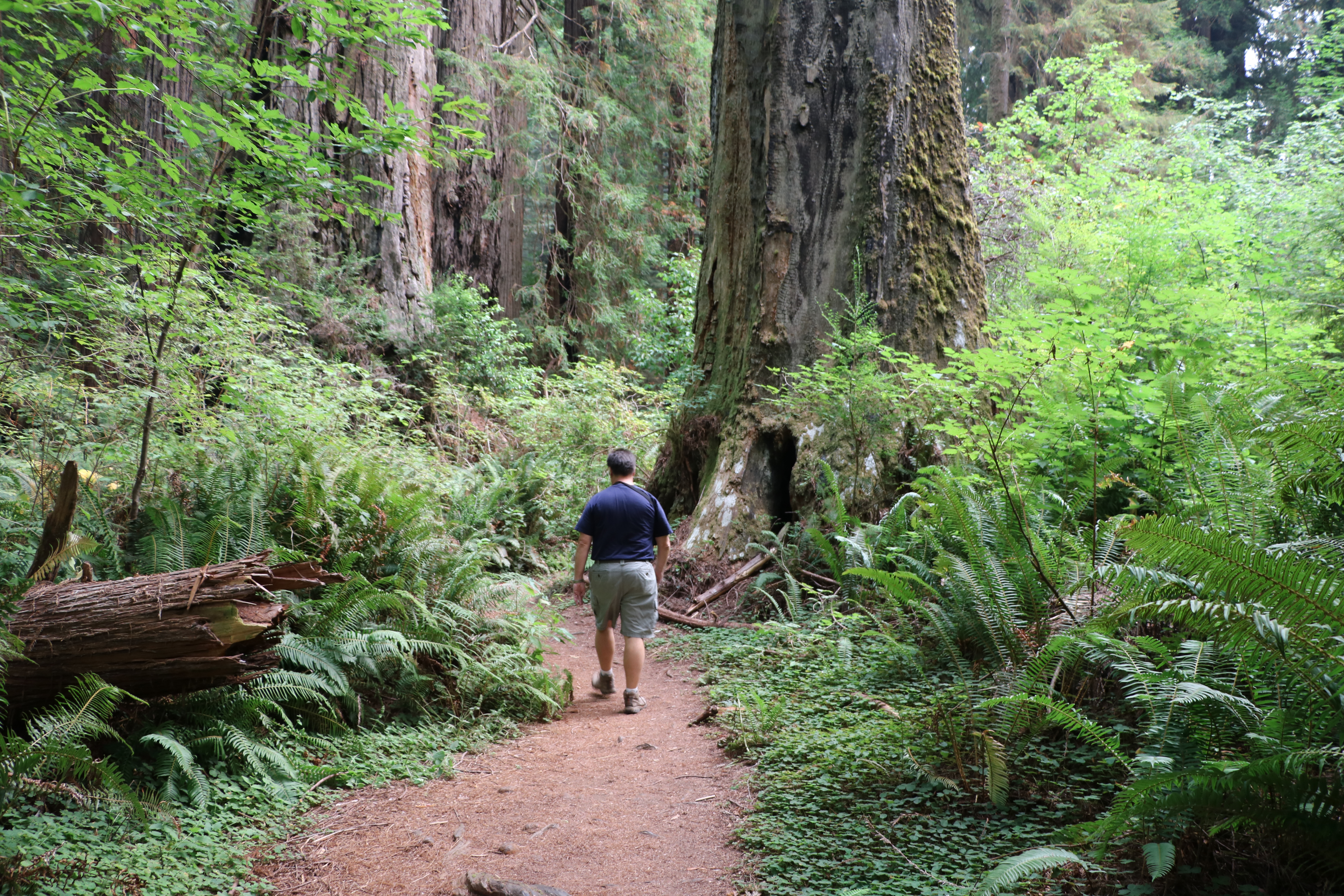
On our first day in the area, we spent several hours at Muir Woods National Monument hiking the easy trails, gazing at the redwoods (which were not as big as the ones we had seen in very northern California) and listening to ranger talks. Run by the National Park Service, it was about 50 miles south of Santa Rosa.
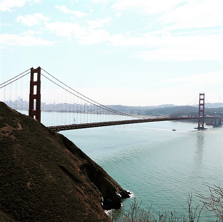
Since we were only about 20 miles away, we decided to drive across the Golden Gate Bridge and into San Francisco. Just before we got on the bridge, there was a place to turn right into part of the Golden Gate National Recreational Area. The road winds higher and higher. There are several mini parking lots along the way so people can get out of their cars and snap photos like the one above. People bike ride and walk across the bridge; there is a really spacious lane on the right side just for those purposes.
After we drove across the bridge we just kept driving and just took in the sights. When we got hungry we found a parking lot, a restaurant, and a really great salad – the story and the recipe are posted HERE.
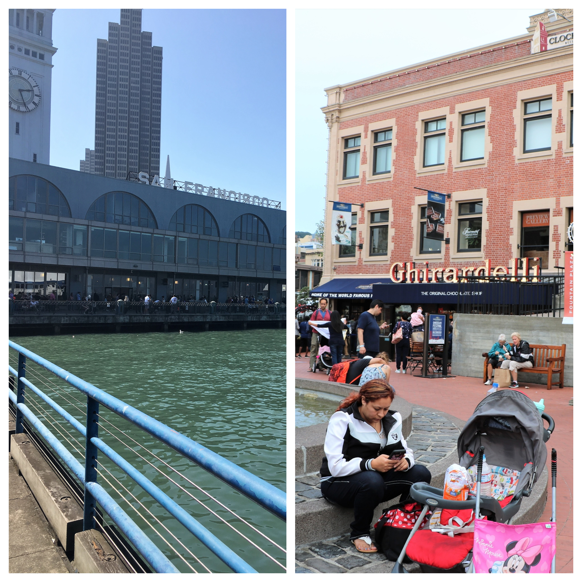
We also spent three full additional days in the city. On one of the days we drove to Larkspur, where we took the Golden Gate Ferry. Since it was Saturday, we didn’t have to pay for parking and the ferry wasn’t crowded. The boat took us to the San Francisco Ferry Building. It has a long history and isn’t just a terminal for ferries, but has eateries and shops within the beautiful renovated building. The second time we went into San Francisco for the day, we drove all the way in and parked our Jeep in the garage in Ghirardelli Square. It’s another marketplace with stores, restaurants and of course a retail space for buying chocolate. For our final day in San Francisco, we drove to sites where we needed the car not only to get to them but as a site seeing vehicle.

We began our exploration of San Francisco by buying a trolley pass in the ferry building and we found it was an easy way to get around the main parts of the city.
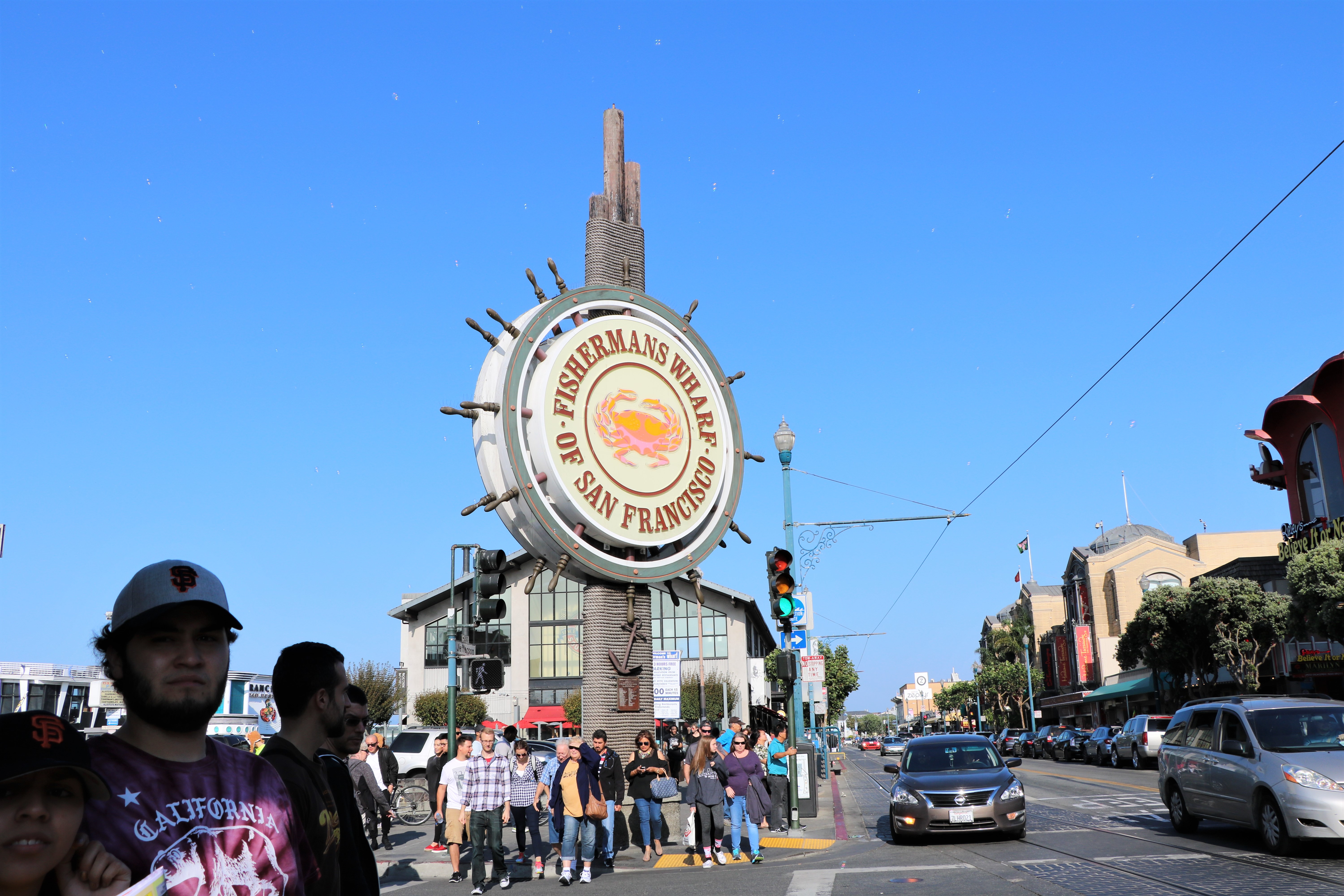
The Fisherman’s Wharf District encompasses the different piers, Ghirardelli Square, the National Maritime Museum, and plenty other historic places we didn’t get to.

Touristy Pier 39 is just a little over a mile away from the ferry building. It has a really nice information center that explained the history of the city and highlighted the must-sees. Located at the end of the pier is a merry-go-round with 1,000 lights and plenty of animals to ride. It was hand painted in Italy with scenes of the city.

On Pier 43 there is the Ferry Arch which is all that remains of a ferry terminal used by prisoners going to Alcatraz as well as an off loading point for lumber, livestock, wine, dairy and grain that would be put onto trains and distributed.
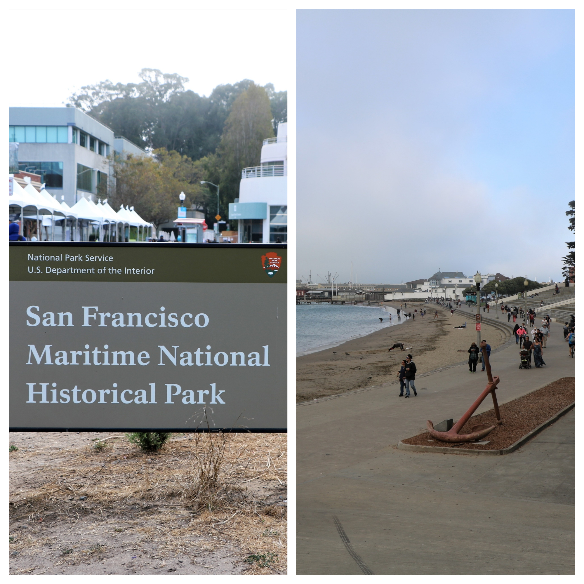
The Maritime National Historical Park and the Maritime Museum are on the shore behind Ghiradelli Square.

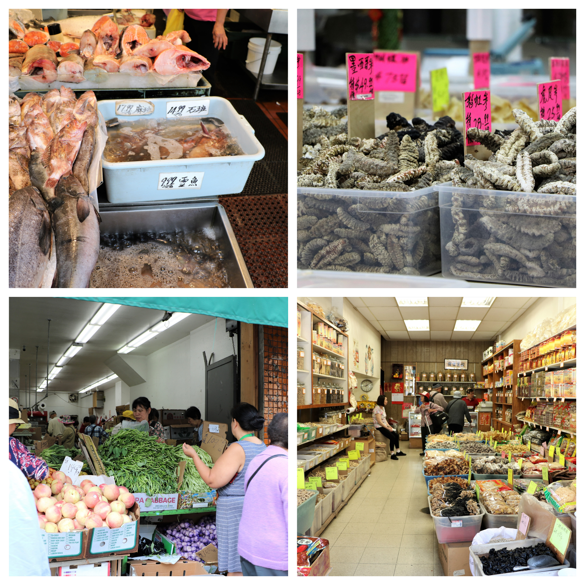
Hustling, bustling Chinatown was really something to see.
I don’t even want to know…

Of course we had to see the Haight Ashbury neighborhood.

These Painted Ladies were in the Lower Haight area. They aren’t the famous ones there were seen on the opening of the show Full House which are in Alamo Square, but since they have three different colors of paint and are Victorian style, they qualify.

We walked up to the top Lombard Street which is said to be one of the most crooked street in the world.
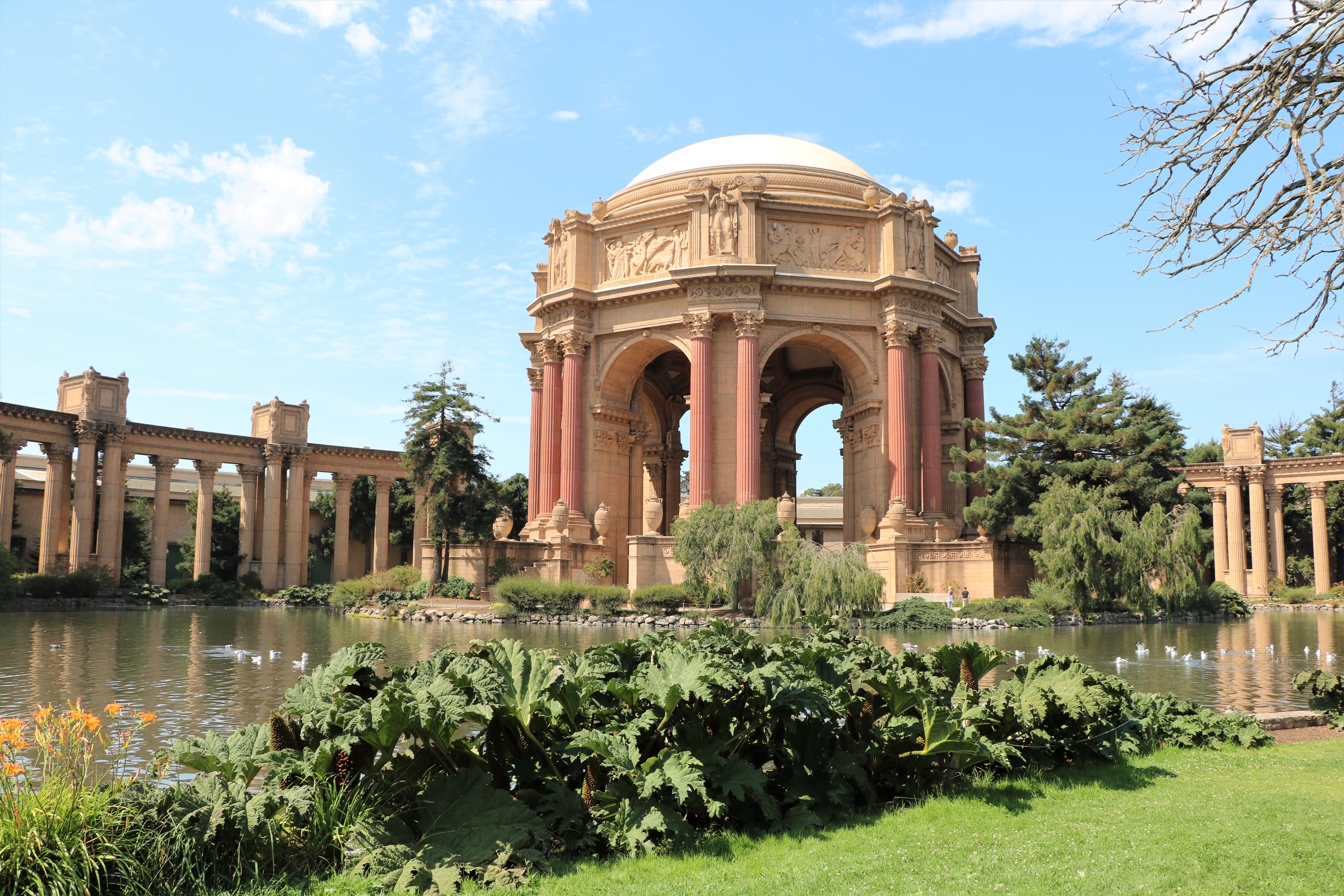
We began our last San Francisco day by driving to the grounds of the Palace of Fine Arts. This structure was built in 1915 for the Panama-Pacific International Exposition. Notice how nice and sunny it was.

It was still clear when we drove all through the Presidio area and stopped at Inspiration Point where we had a view of Alcatraz and the top of the Palace of Fine Arts.

By lunch time, the fog start to literally roll in. We went to the historic Cliff House restaurant because it is supposed to have a great view.
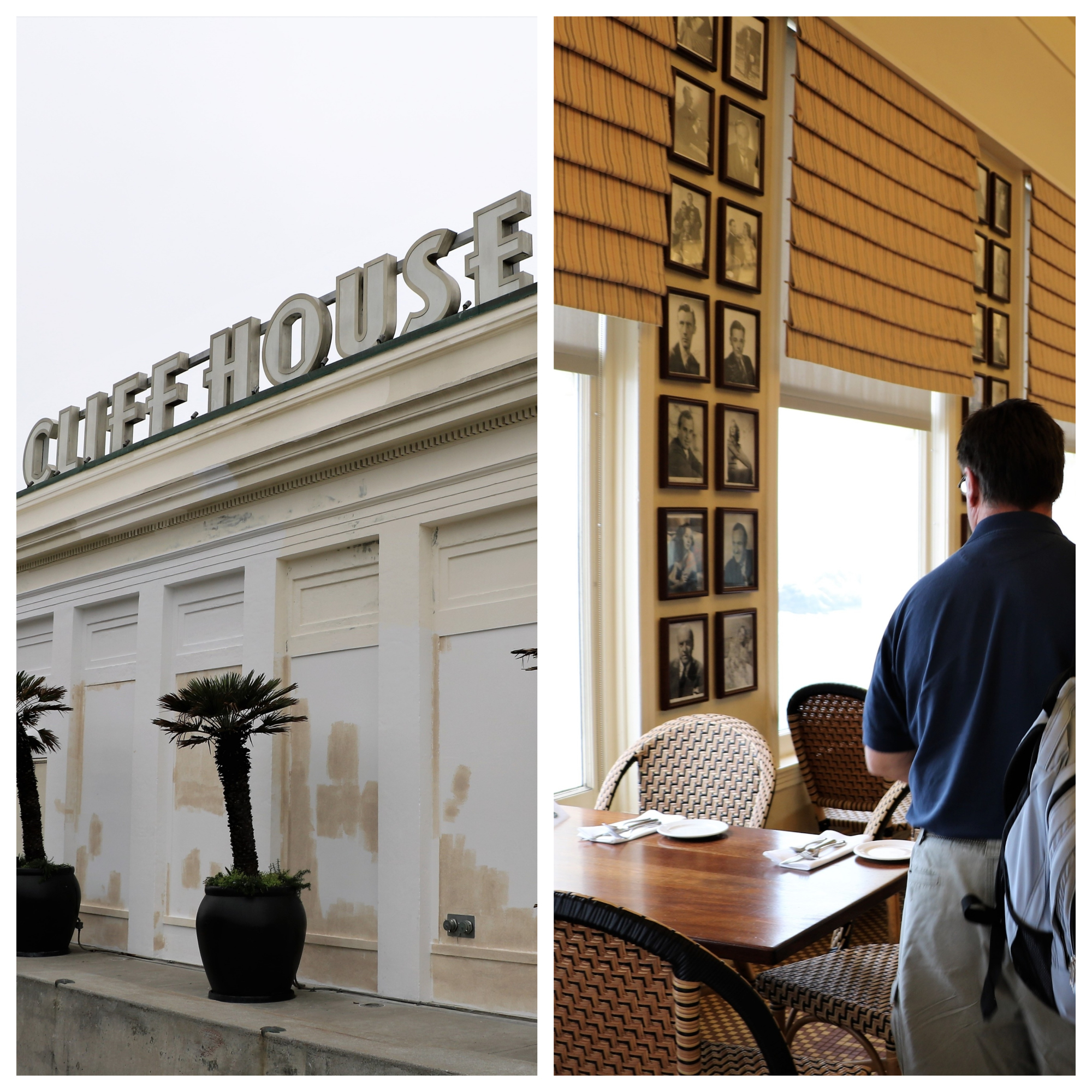
The view was a bit diminished but we enjoyed gazing at the photos of all the famous people that had eaten there and learning about the movies that had included the building in different scenes. I also had the best thousand island dressing I have ever had in my life on a classic Louis salad. Here’s a recipe for it HERE.
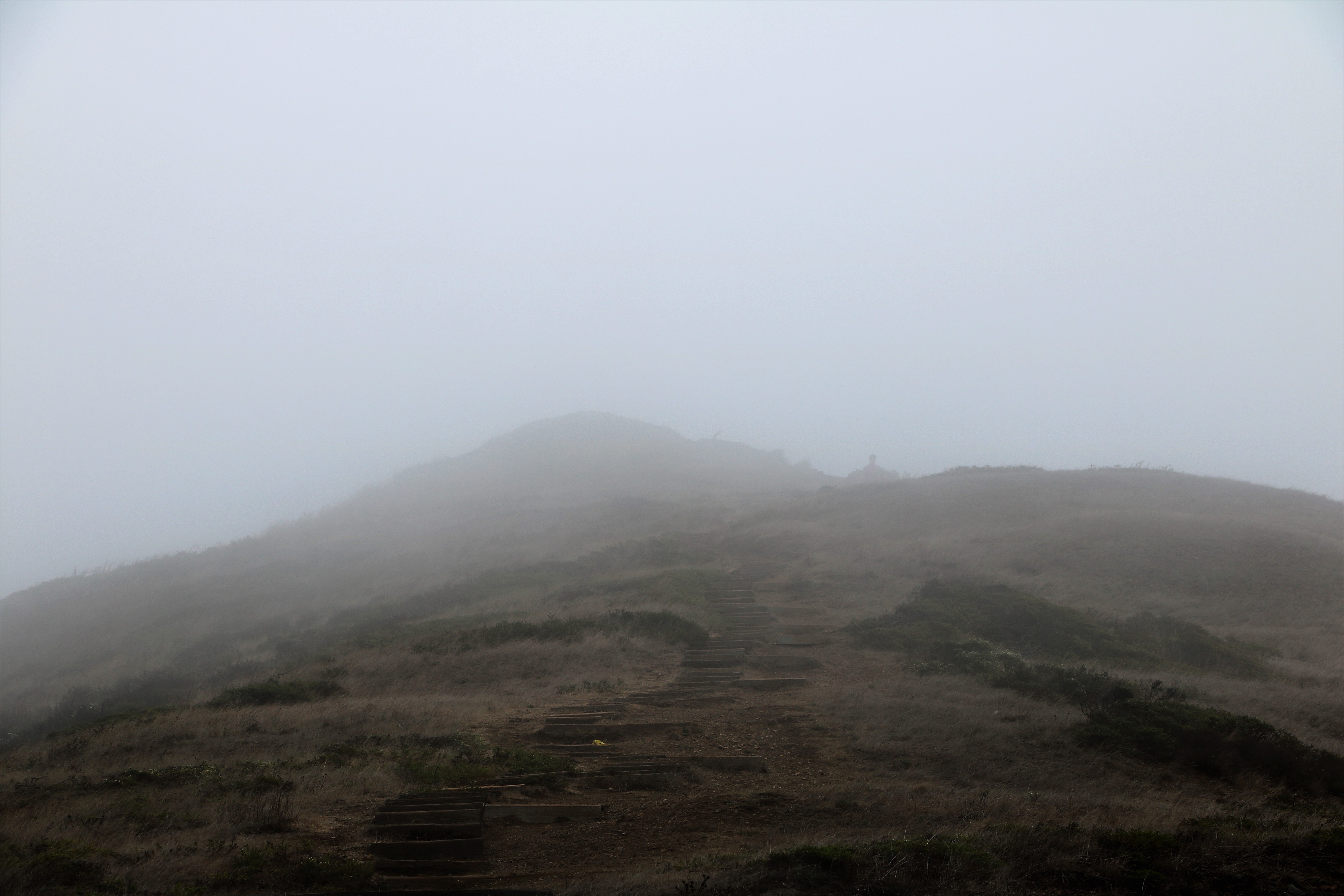
After lunch we headed over to Twin Peaks which is supposed to offer one of the best views of San Francisco. Unfortunately, it was way too foggy to see anything!

One of the great things about staying in Santa Rosa is that not only is it close to San Francisco, but that it’s even closer to beautiful wine country. Napa Valley was about 45 minutes away and Sonoma Valley was just about a half hour.

Roy and I are not wine drinkers but that didn’t keep us from driving through the area and enjoying the beautiful views.
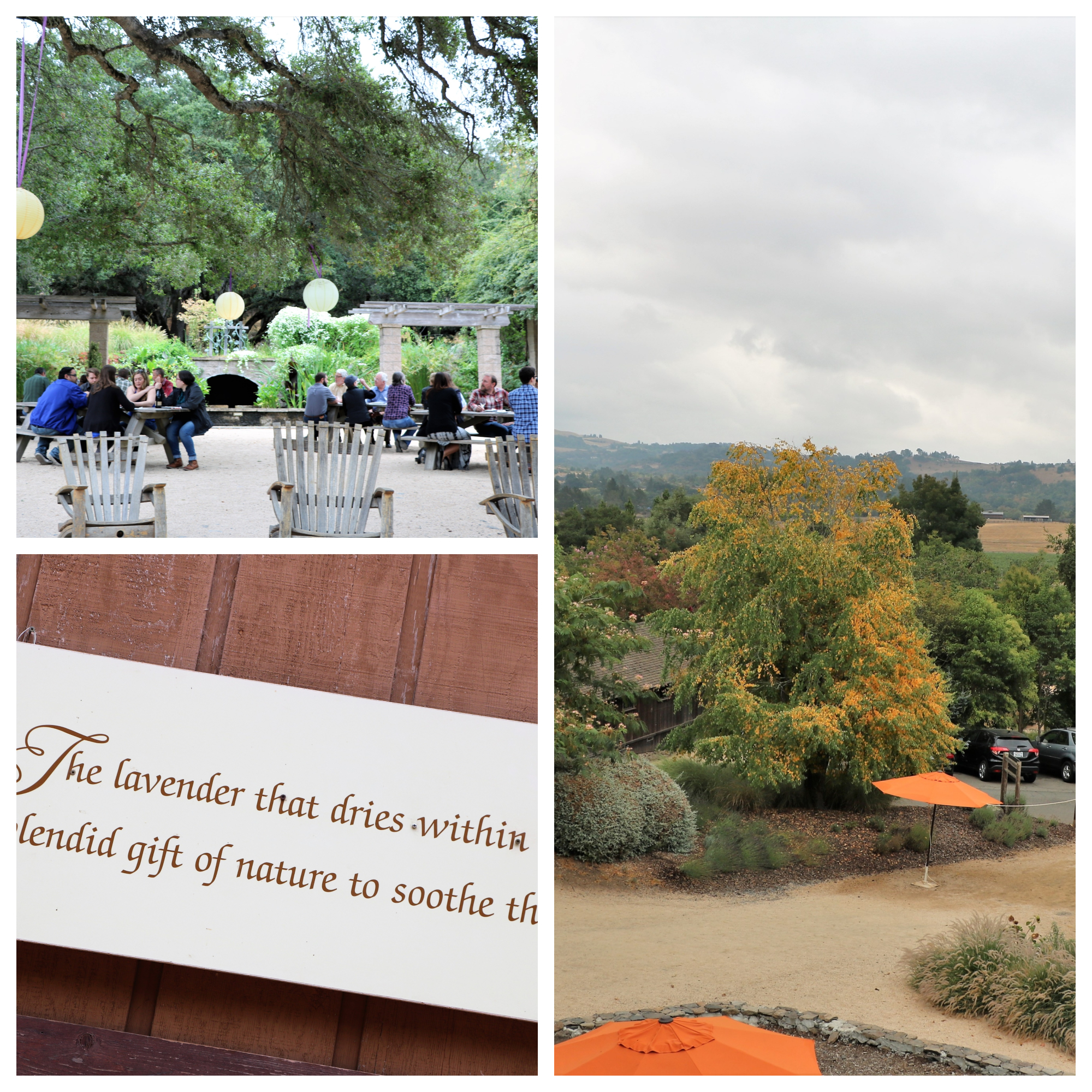
In Somoma Valley we stopped at the Mantazas Creek Winery which is known for the lavender products it sells.
Also in Sonoma Valley is the Francis Ford Coppola Winery where we enjoyed lunch and all the movie memorabilia on display through out the main building. The pool area looked inviting but reservations to use it are said to sell out quickly and it’s best to make them ahead of a visit.
We left Santa Rosa for the Carmel – Big Sur area where we stayed at Carmel by the River RV Park. It was a cutsie little park with lots of potted plants around. However, the last half mile to enter it was one narrow lane with a steep drop off. Swear words were involuntarily coming out of my mouth – and typically I don’t cuss. They didn’t really have any amenities other than a camp store (no pool or anything) and the price was an outrageous $90 a night. But it was close to town and Big Sur.
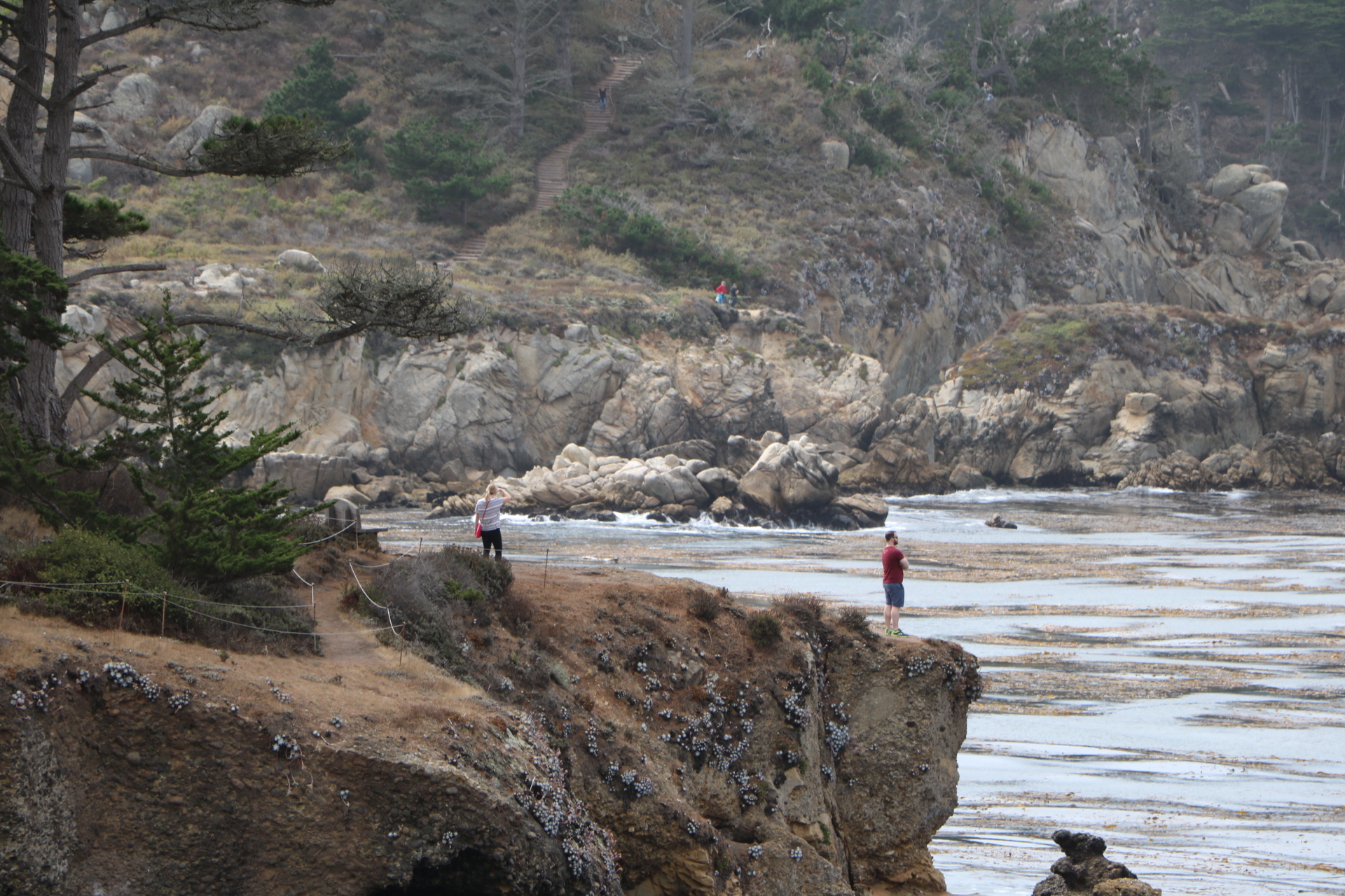
On our first day in the area we spent the morning hiking in Point Lobos State Natural Reserve
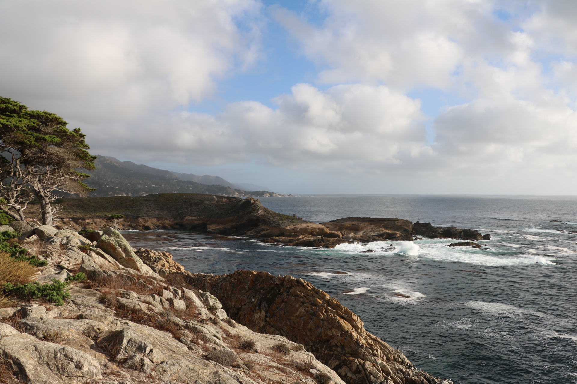
The raw beauty was more breathtaking than a camera could document.

We decided to take a break and eat lunch. We drove just a few miles south on Highway 1 to reach Rocky Point Restaurant where the view was spectacular. After we ate, we returned back to the reserve.

There was lots of wildlife to be seen in the afternoon.

At the end of the day we went to Carmel-by-the Sea and checked out the famous Carmel Beach. The town is full of charming restaurants and shops. None of them have house numbers, they are just addressed by cross streets.
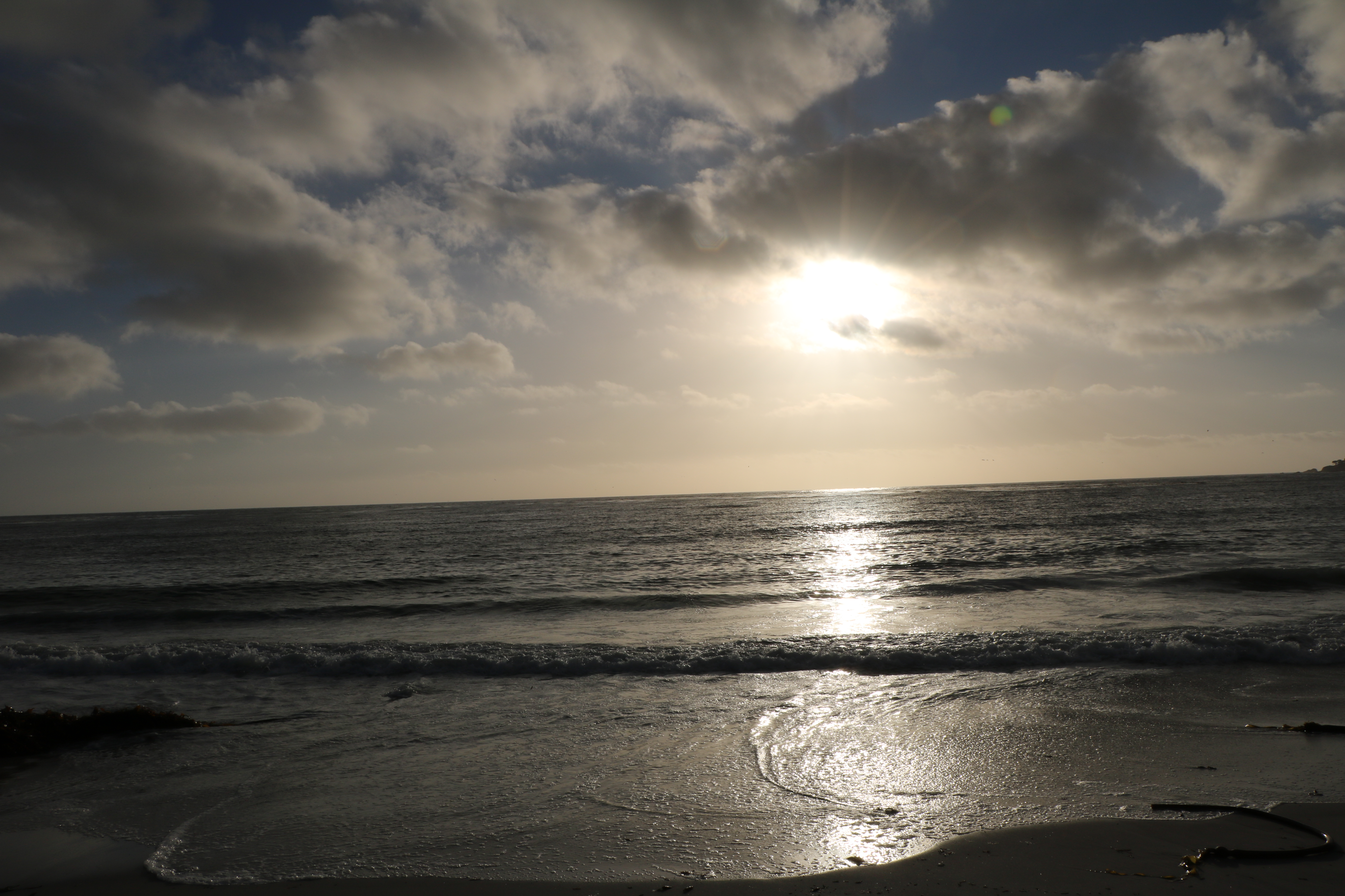
Very pretty as the sun went down.

The next day we went to Pebble Beach and drove along 17 Mile Drive. We saw the famous golf course and lots of other beautiful sights.

There were a large amount of sea lions and seals all hanging out together on Bird Rock. Lots of “barking” too.

The Lone Cypress is the iconic image for Pebble Beach.

On the far left of the photo above is the Ghost Tree, a dead Cypress whose trunk has been beached white by the sun.
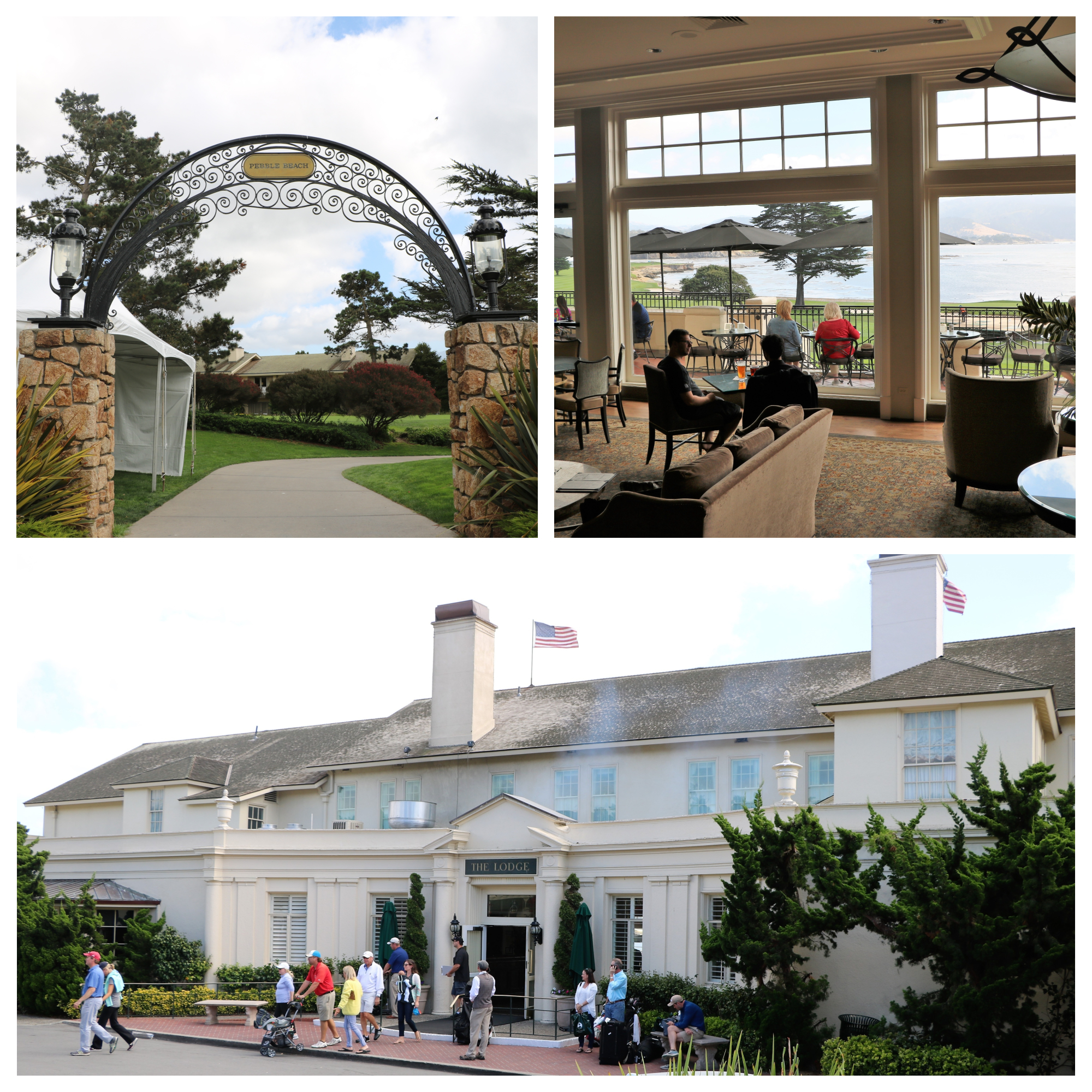
We had lunch at The Lodge. I can’t recall what I ate, but I do remember it was very expensive!
Our next stop was Lone Pine. We stayed at Boulder Creek RV Resort. which was a really nice RV park – nice large sites, great pool – just watch out for the boulders!
The first place we visited was the Eastern Sierra Inter Agency Visitor Center. It was a good introduction to the area and gave us some ideas of what to see. Starting in the 1920s hundreds of films were made just outside of town in Alabama Hills.

The Dow Hotel was built in 1923 and through the years movie crews and actors such as John Wayne, Tom Mix, Gene Autry, and Roy Rogers have stayed there.
We really enjoyed the Museum of Western Film History. It was stuffed full of all kinds of memorabilia from the some of the first westerns made to more recent movies such as a wagon from Django Unchained on the right above.

This plaque along Movie Road going through Alabama Hills just outside of Lone Pine, marks Movie Flats where films and TV series were shot.
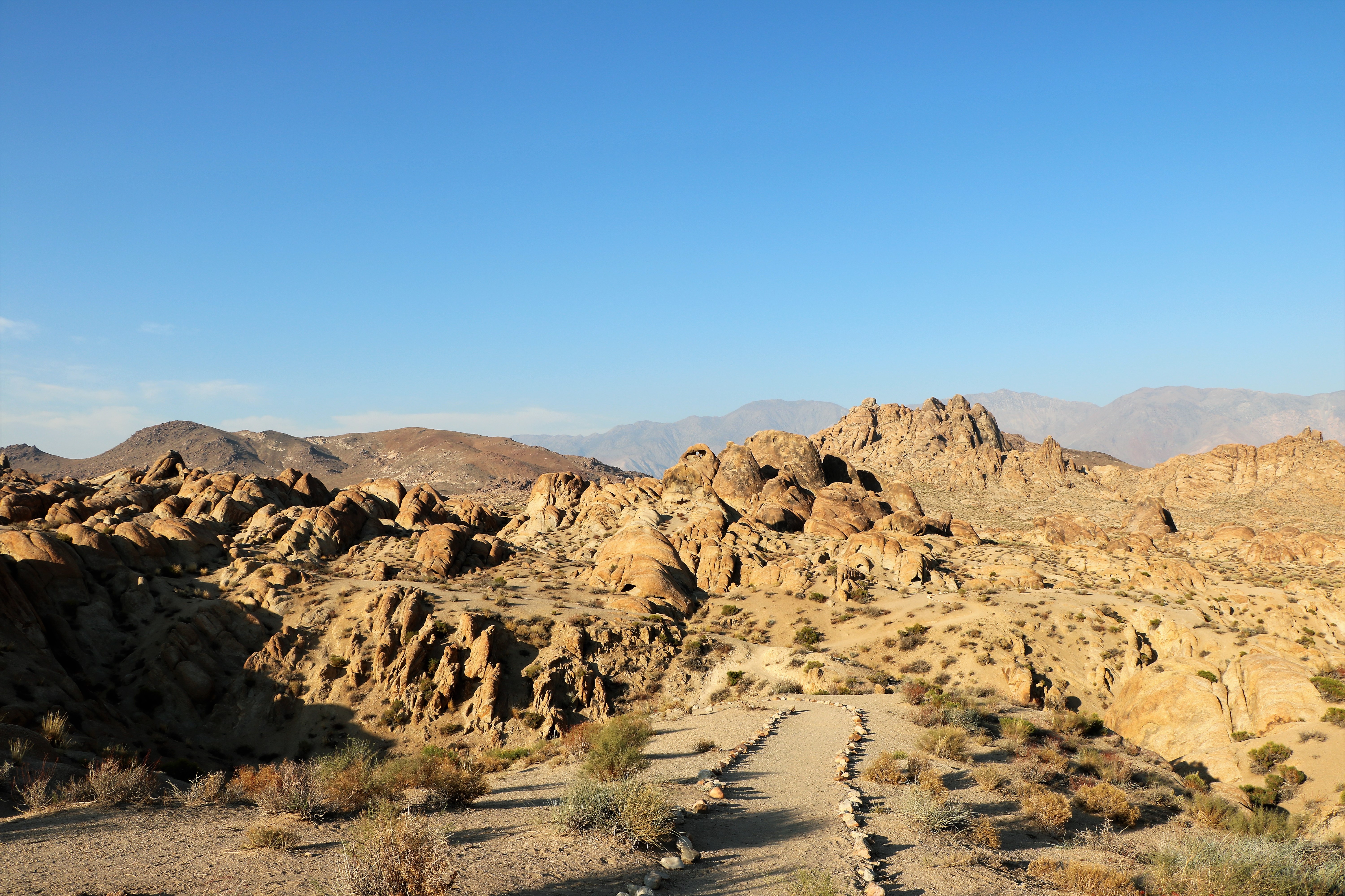
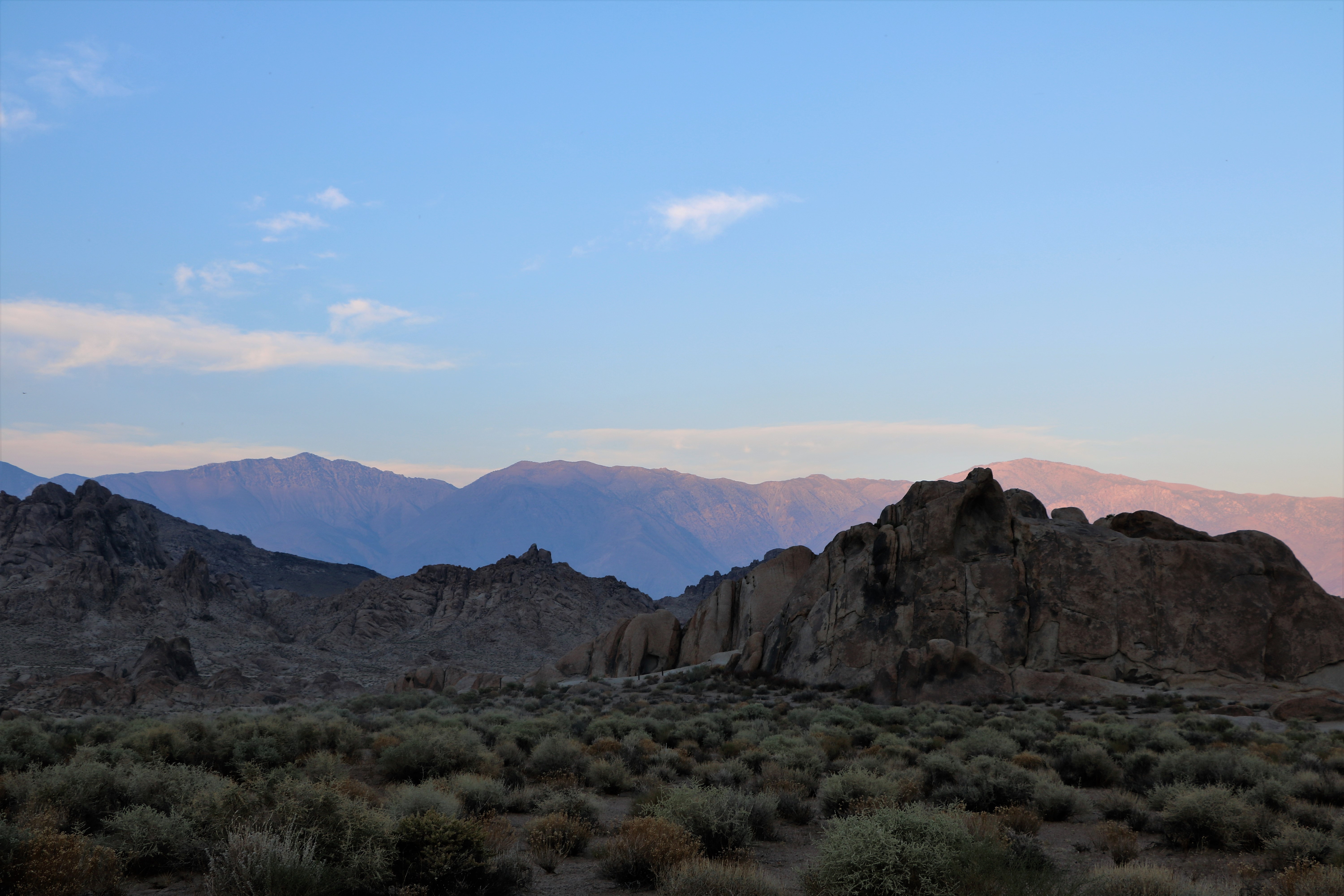
The scenery of the Alabama Hills is just amazing. There are several hikes that can be walked. We took the Arch Trail Loop.
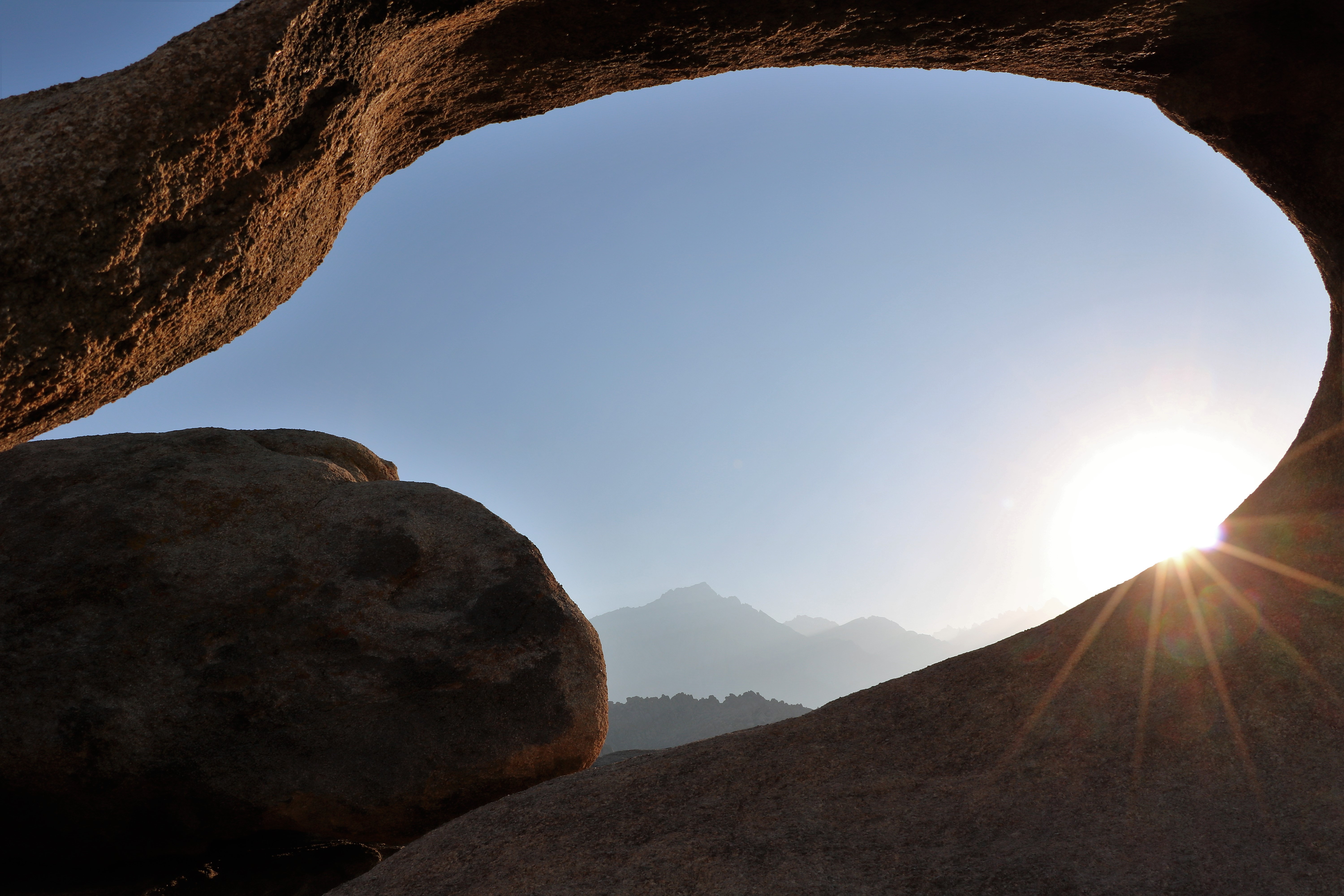
This was out big payoff! If you look through the arch you can see Mt. Whitney in the distance.
We took Whitney Portal Road all the way up to the point where hikers can enter a trail to venture up the mountain.

Mt. Whitney is said to be the highest mountain in the lower 48 states.
The Whitney Portal area was gorgeous and included a camp store for hikers to get last minute supplies.

Driving back down Whitney Portal Road, we could see Owens Dry Lake. Owens lake once was 30 feet deep and helped irrigate the surrounding agriculture. Around 1913, led by William Mulholland, an aqueduct was built to divert the freshwater streams that fed the lake. The aqueduct supplied growing Los Angeles with water and Owens Lake and the farms around it dried up. It’s always was and continues to be a very big controversy in the area.
We left Lone Pine and traveled to the down of Palm Dessert to see some friends of Roy’s parents who retired there.
The front door to their house is on the left in the photo above. They live across the street from one of the homes of Don McLean who wrote the famous pop song American Pie and in the neighborhood that contained the Bing Crosby family compound. The sweet couple took us to see Sunnylands in Rancho Mirage. A photo from the grounds is above right. Now an historic site, it was once owned by the rich and powerful Walter Annenberg and his wife. They hosted U.S. presidents and summits were held there from 1966 until about 2009. The visitor’s center on the site had an interesting film which runs several times a day plus there are lots of photos and an exhibit or two.
After our weekend in Palm Desert we headed toward the place I was really looking forward to most: San Diego!
Since Jennifer is lucky enough to live in San Diego, we have been there several times. We were thrilled to also see Allison who was staying with her. We parked at Campland on the Bay for a week. It’s a huge RV park that is quiet Monday through Thursday but explodes with activity during the weekend. I’m just going to say it: this place gets lit. There is a giant outdoor stage where live bands play, there is a bar/restaurant that is open all hours, and grown men race each other up and down the roads on golf carts. Its also got a really nice pool plus a beach and oddles of kids running around. Crazy.

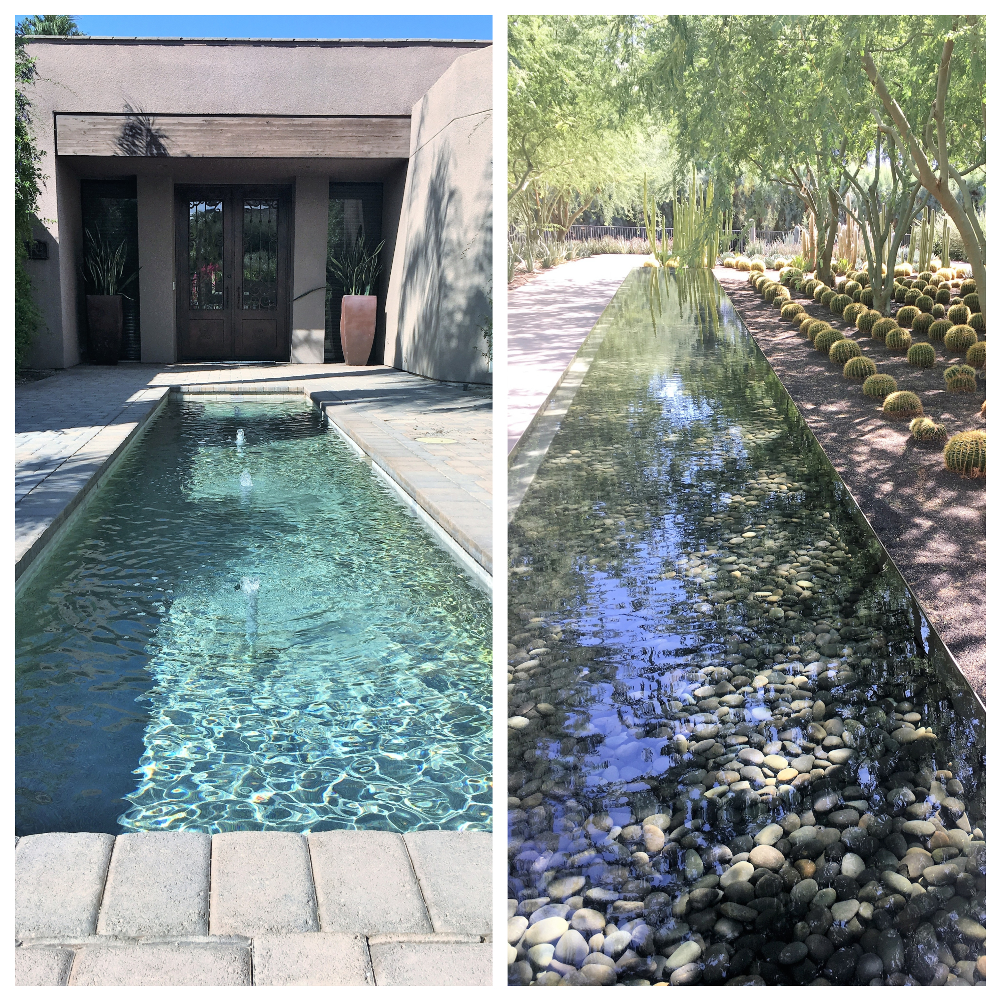
There is so much to do in San Diego! We had already been to many of the must see sights on prior visits, so this time we went to some old favorites but also had some new experiences. One thing we like to do each time we are in the area is hike in Torrey Pines State Reserve which is shown above and below.

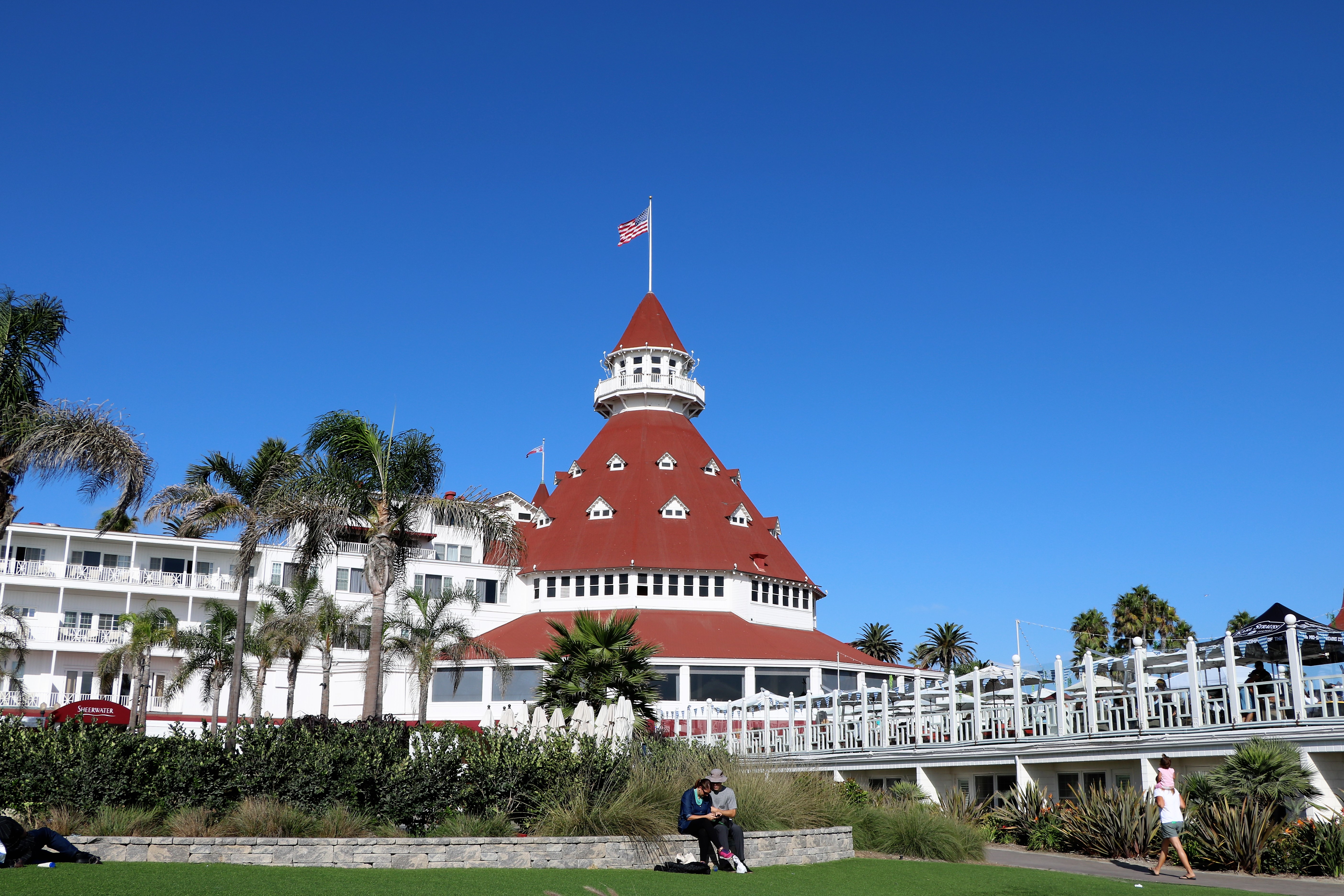
We also walked around Del Coronado Island and the famous hotel.

Besides going to the farmer’s market in the Little Italy area, we checked out the Liberty Public Market that is housed in an old Navy building. Lots of cute stalls selling food and crafty things.
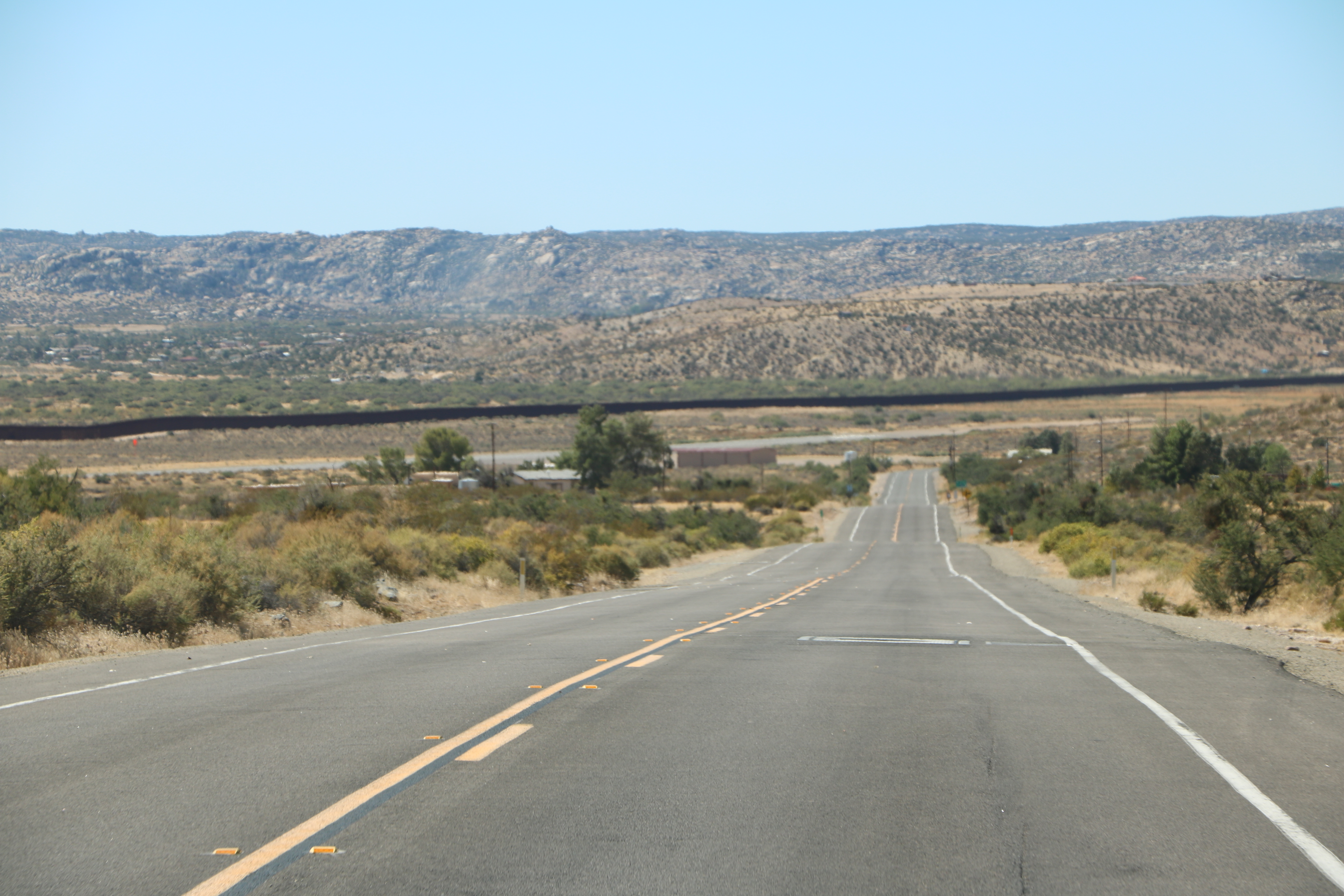
Probably the highlight of our sightseeing came when we took a day long road trip out of town on Interstate 8 and then onto old Highway 80. Allison’s “side hustle” is freelance writing and she needed to do some research on a couple of articles she had in the hopper. That black line about midway in the photo above is the border wall between the U.S. and Mexico.
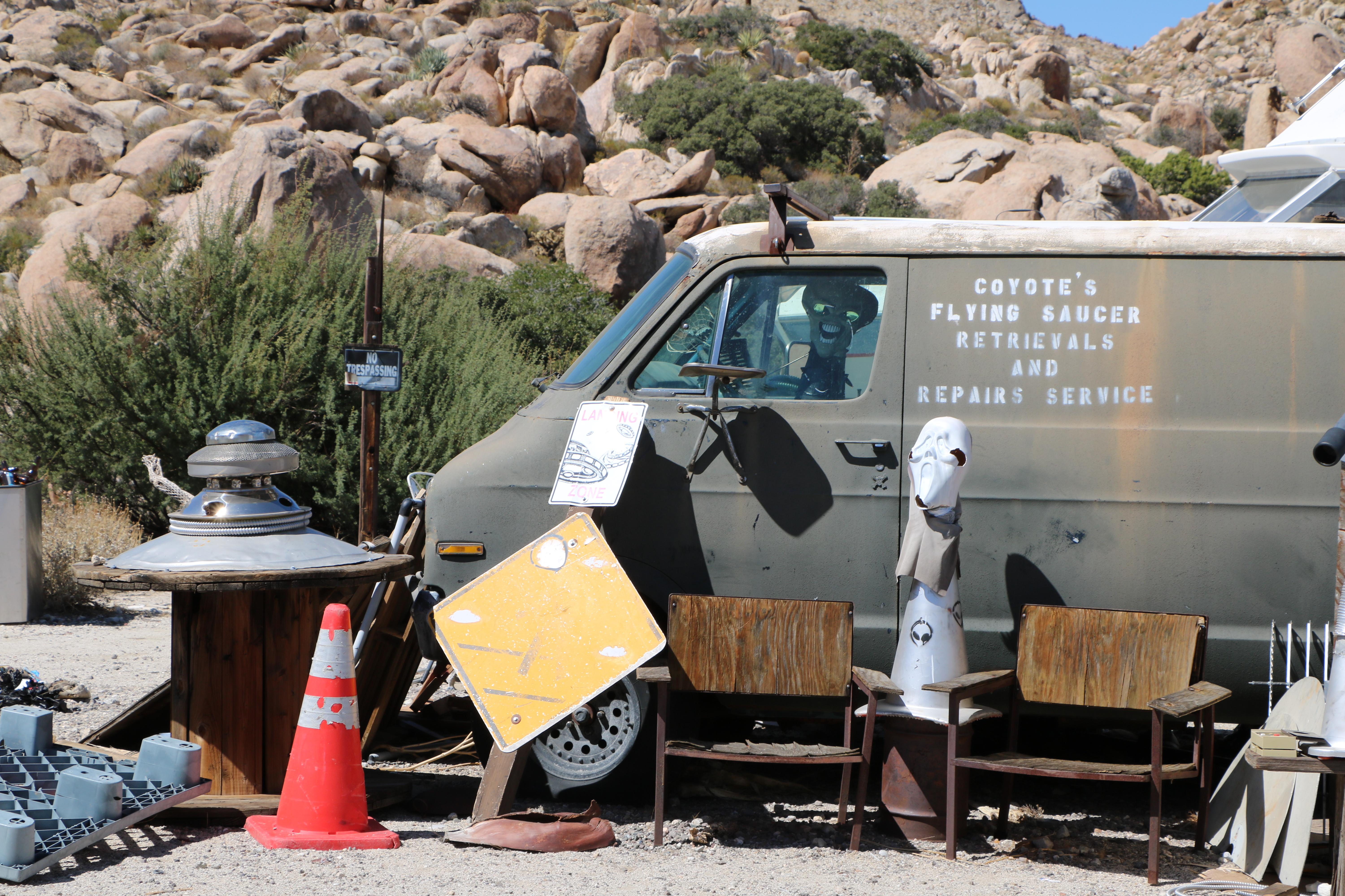
The desert really is a different world. We stumbled on Coyote’s Flying Saucer and Repair Service just before we reached the Desert View Tower, our first intended stop of the day.
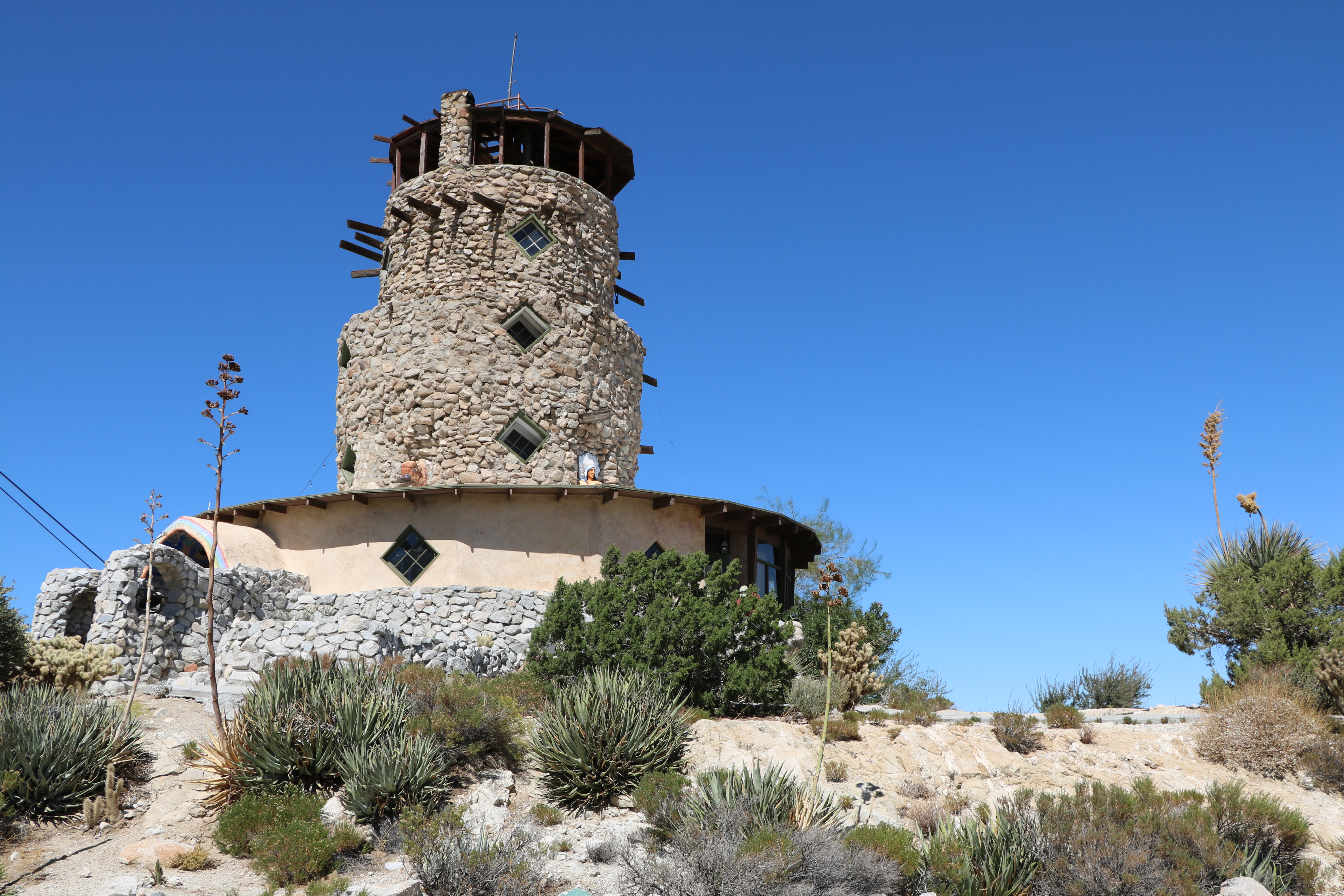
The Desert View Tower It was built in the 1920s as a stop for people making a road trip through the desert. When entering, visitors buy a “ticket” that allows them to walk up the steps to the top of the 70 feet tower. It’s interior is also billed as a museum.
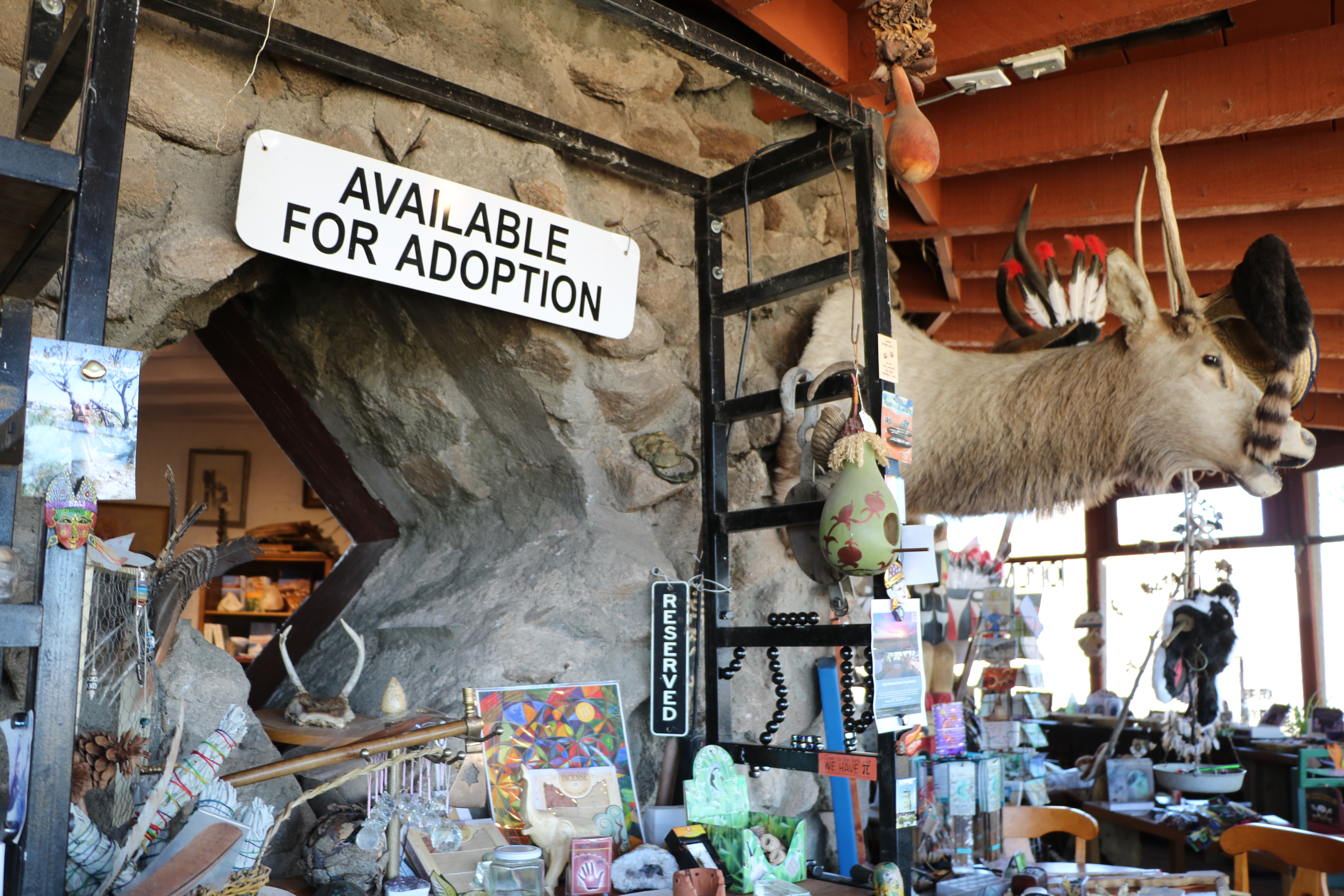
Inside there is a riot of all manner of things for sale; its like a garage sale got married with a taxidermy shop. The purveyor of the site was just as colorful as all the stuff that he was surrounded by.

Here’s the view we saw from the top of the tower.

The “ticket” also allows visitors to walk around Boulder Park that is just outside the tower. During the depression, animals were carved out of the rocks and there is a rough hike that winds through them all.

Apparently, they use the grounds for yoga gatherings as well.

Allison was writing a story on The Border Cafe in the border town of Jacumba Hot Springs, so we stopped there for lunch. Before there was Palm Springs and Palm Desert, this was a place that the rich and movie stars frequented for a spa like resort. It began as a stagecoach stop between San Diego and Yuma, Arizona in the 1920s, but when Interstate 8 by passed it, it most of just sort of shriveled up. There is still a nudest colony nearby and after lunch an interesting couple pulled us into a retail store next door to the restaurant called the Love Shack. We narrowly escaped by buying a bar of soap that was in the shape of San Diego’s Sunset Cliffs.
 Our last stop of the day was to view a temporary art installation on the border wall at Tecate, California. Called “Kikito” it was erected by French artist JR and was about 65 feet tall. He took a photograph of an actual child in the town and achieved his goal of having a toddler look like he was peering over the wall just like the bars of a crib.
After spending a fabulous month going down the west side of California, it was time to start heading home – but we had to go east first and so we ventured into Arizona…
Just for fun, here are some links to some other Yates social media sites:


![]()
![]()


One thought on “California – August 30 to October 2, 2017”